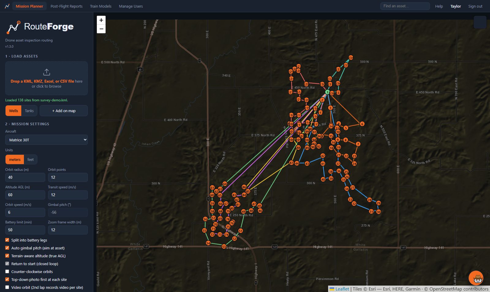
A real 138-asset mission, optimized and split into battery legs — planned in seconds from a spreadsheet.
RouteForge turns a list of assets into optimized drone missions — then turns the photos that come back into client-ready change reports, with AI agents watching for the changes that matter.
Built in the field by working drone inspectors — every feature exists because a flight day demanded it.
Drop in a KML, KMZ, or spreadsheet of assets and get the shortest mission: tour optimization, battery-leg planning around your trucks, terrain-aware altitudes. Less time in the sky, less wear on the aircraft.
Native DJI Pilot 2 missions with per-aircraft zoom control — plus MAVLink export for PX4, ArduPilot, and Blue-UAS-list platforms. One plan, any bird.
First flight surveys each asset from the photos themselves; every flight after that flies tight, full-frame zoom shots at every orbit position. No hand-tuning.
Pre-trained detection agents work your imagery — RGB, zoom, thermal, and OGI — flagging what matters on your sites: surface changes, encroachment, thermal signatures, and equipment that isn't running when it should be.
Every flight compares photo-for-photo against the last one, camera by camera. Branded PDF and HTML reports, plus a daily summary emailed to whoever your customer designates.
Photos and reports live on your machines, not our cloud. RouteForge processes everything locally — site imagery never leaves your custody.
A real 138-asset mission, optimized and split into battery legs — planned in seconds from a spreadsheet.
One tool for the whole day, from the office to the field and back.
KML, KMZ, or a spreadsheet of coordinates — any asset type.
Shortest route, battery legs, terrain-true altitudes, pre-flight warnings.
Export to your aircraft. Photos land with well names baked into every file.
Photos auto-file by well and date into your own archive folder.
Change detection flags what moved. PDF, HTML, and the daily client email.
Inspection data is sensitive. RouteForge is built local-first so it stays that way.